Albertine Rift Valley is part of the great East African Rift Valley system. The Albertine Rift Valley commands a sequence of mountain ranges and other physical features that form Africa’s extraordinary landscape sceneries. Albertine Rift Valley is a dramatic land formation that resulted from tectonic plates pulling apart in the process of faulting and volcanic activity, thus forming ups and downs that resulted in the formation of lakes and mountains.
The Albertine Rift Valley extends through parts of Uganda, Rwanda, Burundi, Tanzania, and the Democratic Republic of Congo. This region is home to various popular plant and animal species most of which are endemic and have greatly stimulated the development of these nations through the tourism sector. Some of the outstanding mountains in this region include
Lendu plateau-Albertine Rift Valley Mountains
The Lendu plateau is a highland in the Ituri province on the northeastern side of the Democratic Republic of Congo and the northwest of Lake Albert. The plateau lies at an altitude between 1700m and 2000m (4920-6560 feet) above sea level. The high land acts as a watershed to the rivers that supply water to Lake Albert and the Congo River Basin. The plateau is composed of diverse ecosystems like savanna grasslands and dense tropical forests like the Ituri Forest which are a favorable habitat for wildlife.
The plateau has fertile volcanic soils that support agricultural practices carried out by the Lendu and Hema People who live in the surrounding areas. These people grow crops like coffee, maize millet sorghum, cassava, and beans. In addition to crop growing is livestock farming.
The plateau has however faced environmental degradation activities like poor farming methods, and poor infrastructure like roads and health services leading to underdevelopment of the region. Despite the above challenges, the plateau remains an outstanding geological feature of great importance to the livelihoods of the natives and the protection of wildlife.
Mountain Rwenzori-Albertine Rift Valley Mountains
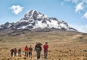
Mountain Rwenzori is one of the Albertine Rift Valley highlands commonly referred to as the “Mountains of the Moon” due to its snow-capped peaks. Lying at the border of Uganda and DRC. The mountain ranges provide stunning views of glaciers and snow-capped peaks with the third-highest peak in Africa at 5109m at Mount Stanley after Mount Kilimanjaro and Mount Kenya.
The Rwenzori mountains act as a great catchment area and an important source of the river that supplies the river Nile. The Rwenzori ranges have a rugged terrain towering above 4000m above the rift valley which makes them noticeable from a distance.
The striking glaciers, snow-capped peaks, V-shaped valleys, fast-flowing rivers with glorious waterfalls, clear blue lakes, and distinctive plant species contribute to the area’s surprising natural beauty. The mountain boasts of several natural wonders which are a highlight of the mountain, and these include the notable peaks which include
Mount Stanley lying at 5109m with Margherita as the highest peak, Mount Speke at 4890 meters, Mount Baker at 4844 meters, Mount Emin at 4798 meters, Mount Gessi at 4715 meters, and Mount Luigi di Savoia at 4627 meters. These mountains are separated by deep gorges and their peaks are permanently snow-capped.
Mount Stanley
At this mountain lies the highest peak of the Rwenzori Mountains known as Margherita. This is the third-highest peak in Africa and the highest in Uganda. this highest peak stands at 5109m (16762 feet) above sea level. The mountain was named after the European Explorer Henry Morton Stanley. The first people to summit Mount Stanley were the Duke of Abruzzi, J Petigax, C. Ollier, and J. Brocherel on June 18th, 1906.
Mont Stanley consists of several lower peaks like Alexandra (5091m), Albert (5087), Savoia(4977m), Ellena (4968m), Elizabeth(4929), Phillip (4920m), Moebius (4916m), Cheptegei (4907m), and great tooth (4603m).
Mount Baker
Mount Baker towers along the Uganda -Congo border towering at 4844m above sea level. It is locally known as “Kiyanja”. It is the sixth highest peak in Africa making a triangular enclosure with Mount Stanley and Mount Speke that encloses the Upper Bujuku Valley. The peak was named after Sir Samuel Baker the first European explorer who just saw the Rwenzori ranges from a distance just to the south of Lake Albert. The Duke of Abruzzi also commanded a summit to this peak and other five peaks on mountain Rwenzori.
Mount Speke
this is another peak on Mount Rwenzori lying at an altitude of 4980m. This peak jointly with Mount Stanley and Mount Baker forms a triangle around the upper Bujuku valley all of which are positioned in the Mountains of the moon. Mount Speke has several summits which include Vittorio Emmanuele (4890m), Ensonga (4865), Johnston (4834m), and Trident (4572m).
Mount Gessi
This is another Rwenzori peak lying at an altitude of 4715m. It was named after an Italian explorer named Romulo Gessi. It lies close to Mount Emin in the northern part of Mount Stanley, Speke, and Baker. Like other peaks, this peak is endowed with Fauna and flora with endemic bird species endemic to the Albertine region. Many animals are always spotted as you hike Via Nyabitaba camp to the summit. This mountain has two twin peaks Lolanda(15470 feet) and Bottego (1541 feet).
Mount Emin
This peak lies at 4798 meters in the north and was named after the explorer Emin Pasha. It is characterized by narrow and rocky ridges and twin peaks including Umberto (1574 feet)and Kraepelin (1572 feet). This mountain peak does not have snow and provides shorter hikes that are mostly started in DRC.
Mount Luigi di Savoia
This mountain range lies at 4627 meters. it is high but less challenging when it comes to hiking. It’s close to Margherita Peak and it’s the sixth-highest peak in Uganda.
The Rwenzori Mountain ranges are known for their striking landscape sceneries that attract hikers from worldwide.
Hiking Mountain Rwenzori takes you through beautiful vegetation zones that are described according to altitude. The zones include the Savanna grassland zone (680-1800m), the Afro-montane Forest zone (1800-2600m), the Bamboo Forest Zone (2600- 2900m), the Alpine and Moorland zone (4000- 4500m) , and the Rocky/ glacier zone (4500-5109m).
Hiking through all these vegetation zones gives you a clear sight and true nature of African wilderness.
The Virunga mountains-Albertine Rift Valley Mountains
The Virunga mountains are a syllabus in the Albertine region. The Virunga mountains are eight volcanoes shared by Uganda, Rwanda, and the Democratic Republic of Congo. They are found in the southwestern corner of Uganda and the northern border of DRC and Rwanda.
Mountains that make up the Virunga ranges include Mount Mgahinga, Mount Bisoke, Mount Karisimbi, Mount Sabinyo, Mount Muhabura, Mount Mikeno, Mount Nyiragongo, and Mount Nyamuragira. Among all these volcanoes, Mount Nyiragongo and Mount Nyamuragira are the only one still active, the rest are said to be dormant.
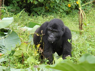
The Virunga Mountain ranges shelter the world’s remaining mountain gorilla species which have become a prominent tourism potential and economic importance to the three countries.
Mount Karisimbi
Mount Karisimbi is the highest of the eight Virunga mountains. Mount Karisimbi is shared by all three countries, Uganda, Rwanda, and the Democratic Republic of Congo. It is an inactive volcano that has not erupted in many years or shown any signs of eruption. It is the eleventh highest mountain in Africa standing at an elevation of 4,507 meters (14,787 feet). The peak of this mountain is snow-capped throughout the year.
Hiking Mount Karisimbi is challenging and strenuous, so one must be mentally and physically ready for the activity. Hiking this mountain starts from either the Volcanoes National Park in Rwanda or Virunga National Park in DRC and it is always a 2-day hike. The hike is very scenic as it gives you a chance to see the grave of the late Dian Fossey, a great primatologist who dedicated her life to the study and protection of mountain gorillas.
Mount Muhabura
Mount Muhabura is at times known as ‘Muhavura’. This is another extinct volcano in the Virungas lying at 4,127 meters above sea level. This mountain is shared by Uganda and Rwanda and is considered the third highest peak of the Virunga mountains though the steepest.
Hiking this mountain can either start in Uganda (Mgahinga National Park) or Rwanda in Volcanoes National Park, it can be hiked within one day. It is most interesting because when you summit, you are rewarded with the breathtaking views of the other volcanoes, and from the Rwandan side, you can spot the Twin Lakes of Ruhondo and Burera and Lake Bunyonyi on the Uganda side.
The more interesting thing about Mount Muhabura is that its Crater Lake is next to its summit and the vegetation is always drier than other parts of the Volcanoes. Unfortunately, the mountain becomes misty which limits distant views of the volcanoes in some months of the year. Therefore knowing the right time to summit the mountain is key.
Mount Mikeno
This is the second highest of the Virunga mountains lying at an elevation of 4437 meters above sea level. This mountain is specifically located in the Virunga National Park of DRC. Its a dormant volcano with the thirteenth-highest peak in Africa and a true home for mountain gorillas.
Mount derives its name from the status of the people around it .’mikeno’ locally means poor. The soils around the mountain are too rocky and rugged which makes survival difficult hence leaving the people in a challenging situation. The slopes are covered by dense vegetation with bamboo and montane forests.
This mountain offers a single-day hike but most tourists to the mountain are always interested in the gorillas that are mostly found in the lower slopes. This mountain is easily accessed from both Uganda and Rwanda by either road or flight to Goma.
Mount Bisoke
This is another Virunga Mountain range created by rift action of volcanic and faulting as tectonic plates cut across different continents forming divergent boundaries that also formed the Albertine rift valley. Mount Bisoke in the Albertine rift, extends across the borders of Rwanda and DRC.
This mountain is hiked from both the Volcanoes National Park of Rwanda and Virunga National Park in DRC. It is one of the most hiked mountains of all the Virunga and is the fourth highest at an altitude of 3711 meters.
Mount Bisoke provides a one-day hike starting from the Rwanda side, summiting Mount Bisoke gives tourists clear views of the two beautiful craters, one at the top and Lake Ngezi found 11km from the summit. The summit has no snow but is often foggy.
Hikes on Mount Bisoke take you through bamboo forests where you may luckily spot mountain gorillas, golden monkeys, and other beautiful mountain scenery. In this mountain is the Dian Fossey tomb site which is also seen when you hike Mount Karisimbi.
Mount Sabinyo
Sabinyo Volcano is the oldest of the Virunga Mountain ranges that lie between three countries (Uganda, Rwanda, and DRC) standing at 3645m. The name Sabinyo was derived from the Kinyarwanda word “iryinyo” meaning tooth.
The serrated nature of the peak resembles an old man’s teeth spaced in a gum line of an old man compared to the perfect conical summit of the neighboring volcanoes in the Virunga ranges. This Volcano is known to be home to diverse wildlife species such as golden monkeys, buffalo, and elephants but more importantly, it provides a home to different mountain gorilla families mainly Agashya, Hirwa, Muhoza, and Sabinyo Group.
However, this mountain can only be hiked from the Ugandan side starting in Mgahinga National Park as the sides of DRC and Rwanda have very steep slopes with sharp ridges and many craters. Hiking can be done on a single day with 4 hours to summit and 4 to descend, making it 8 hours.
Standing at the summit of this mountain gives you exposure to being in three countries at the same time. as it is considered the meeting point of Uganda, Rwanda, and the Democratic Republic of Congo. Views at the summit are worth the hike.
Mount Gahinga
This is another dormant volcano that is part of the Virunga Mountain range. This mountain lies at the border of Uganda and Rwanda at an elevation of 3474 meters (11400 feet) the name Gahinga originated from a Kinyarwanda or Rufumbira word meaning ‘pile of stones’. On this mountain is Mgahinga National Park, a prominent home to mountain gorillas and golden monkeys trekked from the Uganda side. More animals can be sighted as you hike through the thick bamboo forest.
When you summit this mountain, enjoy the breathtaking views of a swamp and once a crater lake point. The summit is also convenient for picnics and photography.
Mount Nyiragongo-Albertine Rift Valley Mountains
This is one active Stratovolcano in the Virunga Mountain ranges. It is found in the Democratic Republic of Congo lying at 3470 meters above sea level in the Virunga National Park. This volcanic mountain is still active and last erupted in 2002. Little monitoring has been done around this mountain due to political instability in DRC. Less is known about the past volcanic eruption records but in 1977 the depth of the lake at the top was estimated to be 10,700ft.
The park offers a two-day hike on this mountain and hikers are expected to spend the night at the summit in the shelters, so the hikers are advised to be well prepared with meals and camping equipment. The hiking gear should be warm since the temperatures fall to 0 degrees. Hiking this mountain is so rewarding as the hikers get to see boiling lava at the top.
Mount Nyamuragira-Albertine Rift Valley Mountains
This is another active volcano in the Virunga Mountain range. It is also found in the Democratic Republic of Congo and lies at an altitude of 3058 meters (10023 feet). It is 20 km away from Lake Kivu but close to Mount Nyiragongo.
It is a shield Volcano characterized by broad gently sloping sides formed by lava flows. This mountain last erupted in November 2011. Hikes to the summit are done in groups of 8 and should be with a tour operator and park guides who are aware of the mountain’s conditions.
Eruptions on this mountain are less explosive but still have an impact on the surrounding population. However, this mountain remains important due to its unique biodiversity and home to mountain gorillas that attract many tourists to the Virungas.
Itombwe mountains-Albertine Rift Valley Mountains
The Itombwe Mountains / Itombwe massif are a series of mountains in south Kivu Province in the DRC lying along the west shores of Lake Tanganyika. The massif is characterized by highland forests, deep valleys, and grasslands.
The Itombwe mountains are found within the nature reserve and part of the Mitumba range on the Eastern side of the country. The highest peak on this mountain is known as Mohi at 3475 meters. The mountain is a prominent home to the eastern lowland gorillas, chimpanzees, and several bird species.
The largest part of the mountain is covered by the Itombwe Nature Reserve which covers over 6009 square kilometers and protects most of the wildlife in the area. Most of the land around the range is not protected though proposals are in progress to conserve the upper region of Elila River that flows from the ranges.
Some of the land remains virgin up to now though the population around the forested ranges have cleared trees for settlement, firewood, agriculture and cattle grazing. Hunting and mining are commonly carried out in the region thus creating a great impact on wildlife
Despite these challenges, the Itombwe Massif remains an important place that should be protected and conserved for its unique wildlife species.
popular hiking safari packages in Albertine rift valley region
8 Day Rwenzori mountain hiking vacation safari

The 8 Days Mount Rwenzori Hiking Safari offers you remarkable Wildlife and Hiking Adventure Tours in Uganda as you watch the various Wildlife animals of Queen Elizabeth National Park and Hike to the top of the highest point in Uganda i.e Magherita Peak on Mountain Rwenzori a block mountain found in East Africa.
| TRIP DETAILS |
| REQUEST INFO |
10 Day Kilimanjaro and gorillas vacation safaris

This 10 days Kilimanjaro & Gorilla safari brings you to the highest peak of the tallest mountain in Africa standing at 5895m above sea level. Mountain Kilimanjaro is the longest single-standing mountain in the world. Although there are 6 routes for hiking the mountain Kilimanjaro, which are; the Shira (Londorossi) route
| TRIP DETAILS |
| REQUEST INFO |
5 Day Uganda walking vacation safaris

This 5 days walking safari enables you the opportunity to explore bwindi at glance the actual walk starts at buhoma park headquarters as you walk downwards the stream river that originates from the impenetrable forest ,the chances of pygmies encounter are many and so interesting.
| TRIP DETAILS |
| REQUEST INFO |

